Places

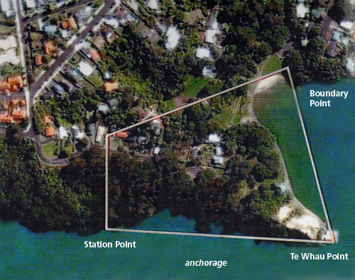
Quarantine station at Blockhouse Point

Researched by Bill Glen

In the early 1860s the Government was concerned that, although immigrants were checked before boarding ship for New Zealand, some passengers took ill on the voyage. There was a risk of contagious diseases entering the country, putting the public at risk. On 12 January 1864 at Government House in Auckland, quarantine regulations were signed into law by Governor George Grey. These regulations required quarantine stations to be set up at main ports, and described the actions to be taken by ships’ masters, harbour boards and provincial governments, to protect the country from introduced diseases.

Continue reading

Sandy Bay

in Places

Almost at the beach end of Blockhouse Bay Road, just on the edge of the beach Reserve, is the pathway to Sandy Bay. There is no car access which adds to the charm of this beautiful little bay. The path cuts back and down on an angle from the main road, bounded on the road side by a stone wall, ending in a stone seat. This was once keenly sought after by courting couples. Then the pathway plunges steeply down towards the shore.

Continue reading

South Whau blockhouse

19th century newspapers are an excellent source for stories on our area and also the early settlers.

Weekly News, 17 February 1883

South Whau blockhouse derelict

At present South Whau looks, as many of our townships have done, an expanse of fern.

The Blockhouse, a relic of the Waikato war of 1863, stands in ruins on the crest of the hill (with its loop-holed embrasures and half-filled trenches), dominating the country for miles around, and at the time of our visit the other day, only the haunt of nomadic gum diggers, who prowl over the adjacent Crown lands for gum. Nothing of a warlike character now remains to remind one of the dark days of civil war, but the empty bottles of “Three Dagger” rum and “Battle Axe” rum strewn in the trenches.

Continue reading

Te Ara o Tiriwa / Gittos Domain Path

in Places

An interesting walk from Blockhouse Bay village through peaceful Gittos Domain.

Start behind the Blockhouse Bay Library. The Blockhouse Bay area was historically serviced by a mobile library. After repeated requests including a ‘sit in’ protest at a council meeting, locals were successful and their library was opened in 1995.

Follow the path to historic Armanasco House - a kauri farmhouse built in 1890 that’s one of the earliest houses in Blockhouse Bay.

Continue reading

Te Whau Point — the decline of a landmark

in Places

On early survey maps of the Whau area, now Blockhouse Bay, and charts of the Manukau Harbour, Te Whau Point is clearly marked. Jutting into the sea it acts as a protective arm for the beach. The pine tree-crowned cliff face could clearly be seen when coming up the harbour and made an attractive landmark for boaties.

Te Whau Point in the 1880s, showing mangroves in the bay

Te Whau Point in the 1880s.
The trees in the left foreground are mangroves.

Continue reading

The Blockhouse Bay sea wall

in Places

Before the early 1930s Blockhouse Bay, being typical of the Manukau Harbour, was a muddy tidal exit for two streams. On 23 April 1930 Mr. P. Turner convened the first meeting of the Blockhouse Bay Improvement Association, with a committee of eleven interested local residents. Its first aims were to protect the foreshore and improve the reserves. The Auckland City Council was approached about building a seawall to protect the reserve area from erosion from the sea which was taking place, and improve the reserve. The Association was prepared to contribute £200.00 ($400.00) — at the time a large amount of money — towards the cost of the project.

Continue reading