Notes on some features of the Manukau coastline,
from Green Bay to Onehunga
A.W.Glen, November 2006
Green Bay
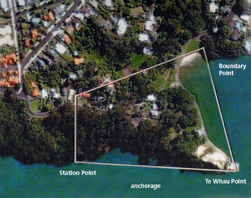
Green Bay is at the western end of the Blockhouse Bay Historical Society’s bailiwick. The bay is a small indentation in the coastline on the inner channel. This bay was the southern exit of the old Maori portage from the Waitemata to the Manukau, via the Whau River. The route was a direct path from the Kaipara Harbour through the portage to the Waitemata, and then inshore to the entrance to the Whau river between the Te Atatu and Rosebank Peninsulas. A stream from the Whau branched off at New Lynn and followed up on the east side of the present day Portage Road, to near Craigavon Park. Another smaller stream exited from Craigavon Park and flowed to the Manukau on the east side of Green Bay Road. This stream entered the Manukau beside the beach facilities building and its course is a deep gully between the road and Motu Moana Camp, the Scout Association’s property on the east side of the gully. There has been some filling and land reforming for roads and facilities between the Connaught and Kinross Road intersections. The distance between the two streambeds was about 200 yards. The streams, although not large, would have had enough water in them, at most times of the year, to lubricate mudslides so that the canoes only had to be carried a short distance. At the west end, a short distance from the beach is a rock breastwork, part of the sewerage holding tank which is no longer in use, the sewerage being pumped to the Mangere Treatment Plant.
Continue reading


